
Route: Lingmoor Fell
Area: Southern Lake District
Date of walk: 6th October 2017
Walkers: Andrew
Distance: 8.5 miles
Ascent: 1,900 feet
Weather: Sunny at first, then light cloud
Lingmoor Fell was yesterday’s Plan B as a hedge against cloud covering the higher tops. In the event they were cloud free, and so yesterday’s Plan B became today’s Plan A. I parked in the National Trust car park in Elterwater and crossed the road bridge over Great Langdale Beck, heading towards the slate quarry. Lingmoor Fell is renowned for its beautiful green slate and has been extensively mined for it – evidence of this is abundant on the early section of the walk
I followed an old mining track for a while before leaving it to climb up the open fellside to gain the summit ridge, where views towards Windermere opened up. I then followed the undulating ridge to the summit cairn, one of the best places to admire the Langdale Pikes, and also Bowfell where I’d walked yesterday. The ridge then continues beside a dry stone wall which resembles a rollercoaster as it snakes up and down. Some of the descent sections are quite steep, and include a rock groove which has been polished to a fine sheen by countless bottoms shuffling down it, but there are no difficulties
Eventually I encountered the rock wall of Side Pike, the top of which is accessible via a narrow path to the left, but this does not provide a way off the fell and so just before reaching it I descended in the direction of the road to Little Langdale. I followed a path which skirts round the foot of Side Pike, avoiding the road, and this then joined up with the Cumbria Way. From here it was an easy walk through the fields, and then through woodland, back to the start of an excellent walk
For other walks here, visit my Find Walks page and enter the name in the ‘Search site’ box
Click on the icon below for the route map (subscribers to OS Maps can view detailed maps of the route, visualise it in aerial 3D, and download the GPX file. Non-subscribers will see a base map)

Scroll down – or click on any photo to enlarge it and you can then view as a slideshow

The start of the walk from Elterwater as I cross the bridge over Great Langdale Beck

Great Langdale Beck

I follow the path beside the beck to the quarry

Burlington Stone have quarried slate here for 400 years

Looking across to the Langdale Pikes

The path leaves the course of the beck, and I head uphill through Sawrey's Wood...


More evidence of quarrying

A view into Great Langdale

Beyond the woods I follow the old mine track

Looking back down to the main quarry, which I'd passed through earlier

Chapel Stile across the valley

I emerge onto open fellside

A cairn at the start of the summit ridge, here looking towards Windermere

Looking along the ridge to the summit of Lingmoor Fell in the distance

The summit top left and Harrison Stickle on the right

Pike o' Blisco, Crinkle Crags and Bowfell

I follow the path beside the undulating dry stone wall

Summit of Lingmoor Fell

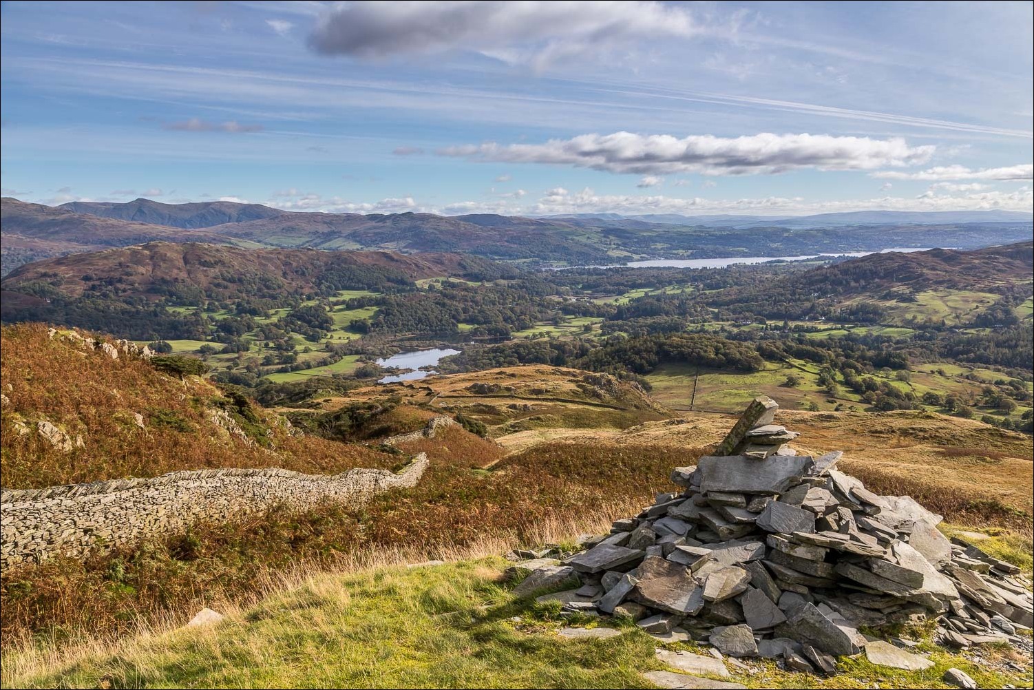
Looking back along the ridge, with Windermere on the right

The Band, leading up to Bowfell, the subject of yesterday's walk

The descent path follows the line of the ridge, with wonderful views ahead...

The head of Great Langdale looking into Micklenden

This is perhaps the best place to view the Langdale Pikes, L to R - Pike o' Stickle, Loft Crag, Thorn Crag, Harrison Stickle and Pavey Ark

Looking down to Blea Tarn

Side Pike near the end of the ridge

Side Pike again

More wonderful views of the Langdale Pikes...

...and Side Pike

Side Pike presents a barrier to a direct descent, though can be climbed via the path to the left, returning the same way

I followed this path down into the valley and skirted around the foot of the fell

Blea Tarn

Path to Blea Tarn

Mickleden, as I round the corner

Stool End Farm near the head of Great Langdale

Further round the foot of the fell, and now heading back along the valley

Looking back to The Band and Bowfell

I pass by Side House

A view back along the path

The Cumbria Way

Looking back to the Langdale Pikes

The path then enters into woodland, with Great Langdale Beck on the left...


I arrive back in Elterwater to end a great walk

9pm that night, a hedgehog visits for supper...

...and 8am next morning a breakfast visitor
