
Route: Lanthwaite Hill
Area: Western Lake District
Date of walk: 13th November 2015
Walkers: Andrew and Gilly
Distance: 3.0 miles
Ascent: 400 feet
Weather: Very windy, some bright spells
We’d spent the morning raking what seemed like a ton of leaves from the garden, and didn’t have the time nor the energy for a longer walk – it was a good opportunity to revisit one of our favourite local walks
For the second day in succession we parked in the National Trust car park at Scale Bridge and, instead of heading along the wide track to the foot of Crummock Water, we turned uphill and climbed up the rocky staircase which leads to the top of Lanthwaite Hill (or Brackenthwaite Hows as the OS calls it)
The views from the top are wonderful in all directions. We’ve been up here numerous times and have never seen another soul, maybe because the path to the top is not shown on the OS. After admiring the views for a while we re-entered Lanthwaite Wood. The path skirts the edge of the wood, with good views across Lanthwaite Green to Grasmoor
We then descended to the shore of Crummock Water and walked back to the start along the track through Lanthwaite Wood – a wonderful short walk which is always a delight
For other walks here, visit my Find Walks page and enter the name in the ‘Search site’ box
Click on the icon below for the route map (subscribers to OS Maps can view detailed maps of the route, visualise it in aerial 3D, and download the GPX file. Non-subscribers will see a base map)

Scroll down – or click on any photo to enlarge it and you can then view as a slideshow

Red squirrel in the garden before we set off this morning


Later that day, a swollen River Cocker seen from the car park at Lanthwaite Wood

Rocky staircase on the way up Lanthwaite Hill

We emerge from the Lanthwaite Wood onto the ridge of the hill

It’s a short walk from here to the top of Lanthwaite Hill

Lorton Vale, with High Lorton in the sun

Bonnie

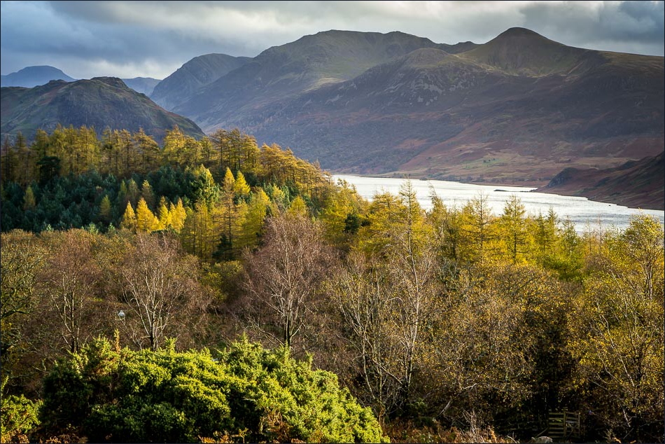
Crummock Water and the High Stile Range from the top of Lanthwaite Hill


Loweswater

The foot of Hencomb

Hencomb again

Rannerdale Knotts as we descend back into Lanthwaite Wood


Lanthwaite Green at the foot of Grasmoor

Gasgale Gill and Grasmoor

We re-enter Lanthwaite Wood


Grasmoor again

Descending towards Crummock Water

The boathouse

Low Fell

The Shake

We walk along the eastern shore of the lake

Red Pike and Mellbreak from the foot of Crummock Water

Looking back to the boathouse

The outflow of the lake into the River Cocker

We follow the track through Lanthwaite Wood back to the start of a great little walk
