
Route: Lanthwaite Hill and Crummock Water
Area: Western Lake District
Date of walk: 4th December 2016
Walkers: Andrew James and Jason
Distance: 2.1 miles
Ascent: 400 feet
Weather: Sunny
After yesterday’s exertions on Helvellyn we voted for a short local walk this morning and made the 5 minute car journey to the National Trust car park at Scale Hill
From the car park we climbed steeply uphill to the top of Lanthwaite Hill, shown on the OS map as Brackenthwaite Hows. This is one of my favourite places in lakeland. Although the hill is a small one it has extensive and very beautiful views over a large chunk of the Western Lake District, including Lorton Vale, Loweswater, Crummock Water and many of the western lakeland fells. After admiring these for a few minutes we descended into Lanthwaite Wood, skirting around its edge before walking down to the shore of Crummock Water
We turned right at the boathouse to follow the lakeshore path to the foot of the lake, where another tremendous view awaited us
The last part of the walk was along the bank of the River Cocker back to the car park, where we saw several dippers (there is an alternative way back along a wide track running through Lanthwaite Wood)
It was a only a short walk but one that was packed full of beauty every step of the way
For other walks here, visit my Find Walks page and enter the name in the ‘Search site’ box
Click on the icon below for the route map (subscribers to OS Maps can view detailed maps of the route, visualise it in aerial 3D, and download the GPX file. Non-subscribers will see a base map)

Scroll down – or click on any photo to enlarge it and you can then view as a slideshow

Red squirrel in the garden before we set off this morning

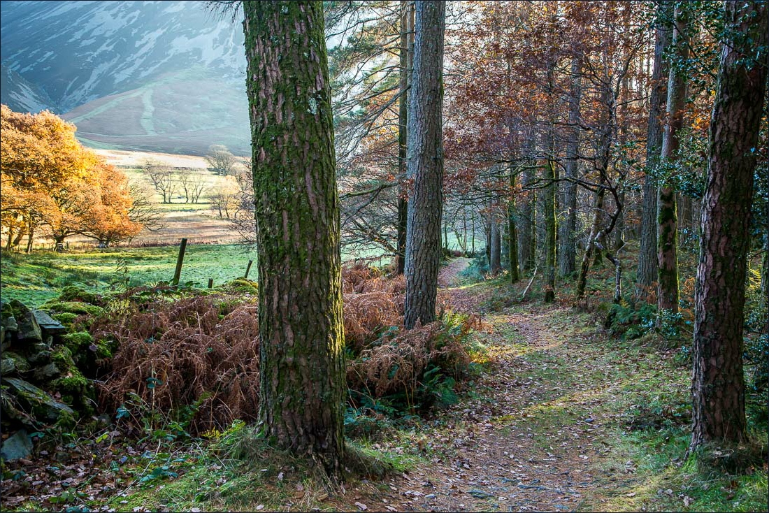
The main track through Lanthwaite Wood - we take a minor path uphill to the left

We follow the narrow path uphill, quite steeply at times, but it’s a short climb

We exit the wood through the deer gate

Lanthwaite Hill ahead (shown as Brackenthwaite Hows on the OS maps)


Looking over Loweswater from the top of the hill - can you spot the Loweswater Pheasant?…

…otherwise known as Holme Wood

The best views, those to the south, were hard to photograph thanks to the blinding low sun - here is a silhouette of Great Gable in the distance

Looking the other way - sweet Lorton Vale

Mellbreak and Crummock Water

Descending into the sun towards Crummock Water

We arrive back in Lanthwaite Wood

The path follows the edge of the wood

Lanthwaite Green on our left

Whiteside

Descending to the shore of Crummock Water

We arrive at the boathouse

The shoreline path to the foot of the lake


Foot of Crummock Water, looking towards Mellbreak. I couldn’t photograph the otherwise superb view down the lake thanks to the low sun

On the path back along the bank of the River Cocker, we saw several dippers

We notice a rope hanging from a tree, an irresistible temptation to Jason…

…and to James

Looking across the Cocker to Mellbreak…


We follow the riverside path back to the start of a short but sweet walk
