
Route: Langdale Pikes
Area: Central Lake District
Date of walk: 24th March 2018
Walkers: Andrew
Distance: 6.5 miles
Ascent: 2,837 feet
Weather: Mostly sunny
The Langdale Pikes are a spectacular sight when seen from valley level, and a stranger to the area may wonder how an ascent of these almost vertical towers of rock is possible. But it is, as long as you don’t head directly up the rock face. I parked in the National Trust car park at New Dungeon Ghyll and followed the path up the left hand side of Stickle Ghyll, crossing over to the other bank via a wooden footbridge after 10 minutes or so. A well pitched rock path made the steep climb relatively easy and a little while later I emerged at Stickle Tarn, set in a spectacular position beneath the cliff face of Pavey Ark
I followed the path around the shore on the tarn, looking up to some intrepid walkers who were ascending Pavey Ark via Jack’s Rake – a vertiginous scramble which will never feature on this website save through a long lens. After passing by Jack’s Rake (and meeting a couple of walkers who’d retreated from it) I started the steep but safe clamber up North Gully which leads to the summit of Pavey Ark. Hands were needed on a couple of occasions and although the going was rough there were no dangers
I descended from the summit to the vast boggy plateau of Harrison Combe and then climbed up again to reach Thunacar Knott, the second fell on today’s round. The flat terrain in the vicinity of the fell is the only place on the round where quick progress can be made, and before long I was at the foot of Pike o’Stickle. A short but very steep and rocky ascent brought me to the top of this third fell – ‘a tapering thimble of rock’ as Wainwright describes it
After clambering down back to the foot of the fell I made my way over to Loft Crag and then another down and up brought me to the summit of Harrison Stickle, the highest of the Langdale Pikes, a spectacular place with views to match. I could have lingered here for hours, but so far the walk had taken two more hours than anticipated so it was time to start the long descent. After a short pathless section I joined the steep rocky path which leads back down to Stickle Tarn. The path is perfectly safe but it’s steep and rocky and progress is very slow
On reaching the tarn I followed the path down the west bank of Stickle Ghyll for a change – and having now done both I can say without doubt the path to the east is the one to take. The western path is far more rugged and at one point there’s a stile which can’t be crossed by a dog, and I had an awkward few moments carrying Bonnie up and then lifting her down the other side. After a seemingly endless descent I finally arrived back at the New Dungeon Ghyll Hotel to end what had been a fantastic walk
For other walks here, visit my Find Walks page and enter the name in the ‘Search site’ box
Click on the icon below for the route map (subscribers to OS Maps can view detailed maps of the route, visualise it in aerial 3D, and download the GPX file. Non-subscribers will see a base map)

Scroll down – or click on any photo to enlarge it and you can then view as a slideshow

An early morning visit to Crummock Water before I set off for Langdale...


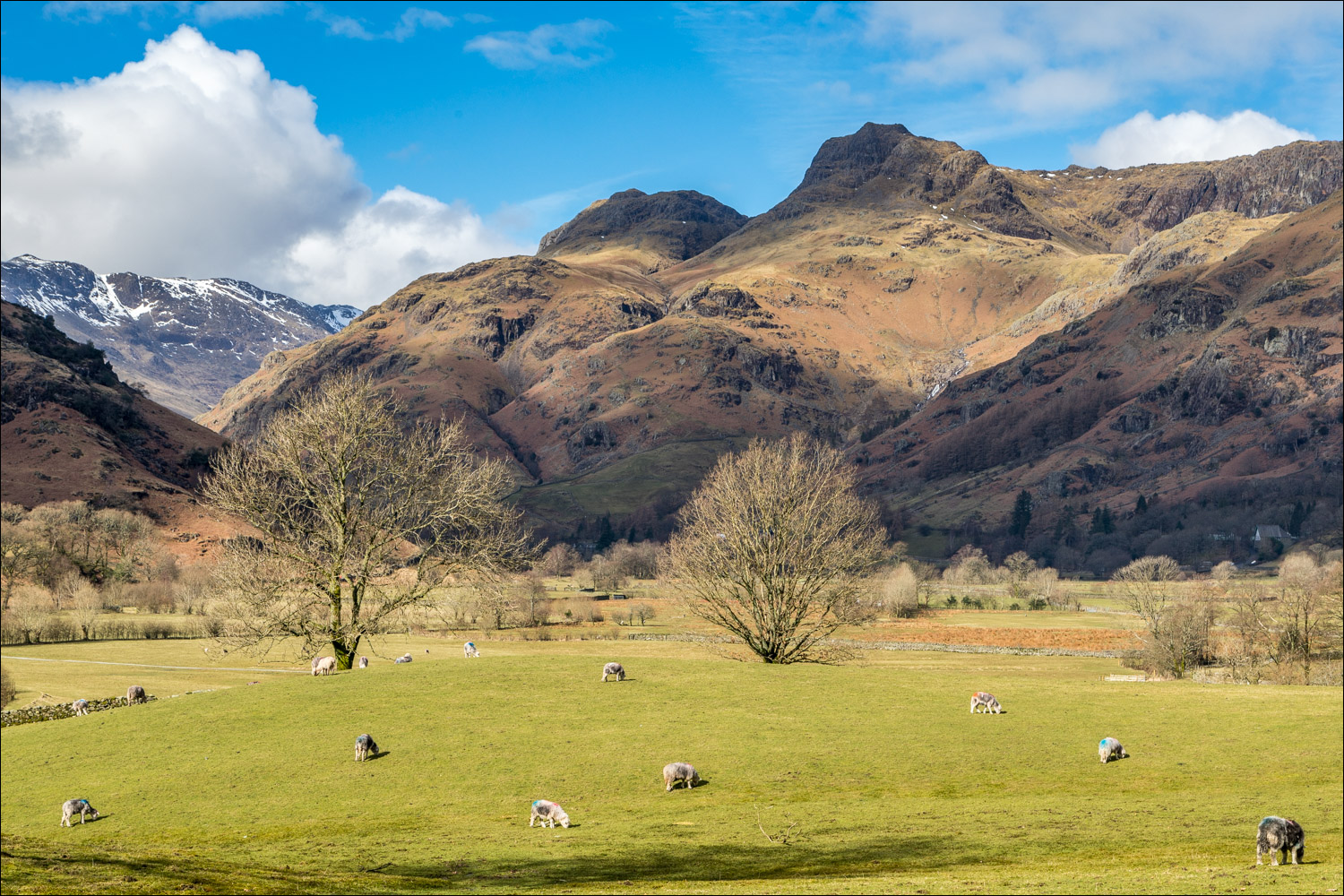
An hour or so later I stopped the car briefly as the unmistakeable outline of the Langdale Pikes came into view

After parking the car at New Dungeon Ghyll I followed the left bank of the ghyll, crossing to the right via the footbridge

I follow the rocky staircase, which passes to the left of Tarn Crag above

Looking back down to the start of the walk

A view back as the path rounds Tarn Crag

Another view back, to Lingmoor Fell and Side Pike

I arrive at Stickle Tarn

Cormorant

The imposing cliff face of Pavey Ark - there is a way to the top via Jack's Rake, running right to left of the photo, but this is classified as a rock climb and is not for me

Zooming in on some intrepid walkers making their way up the rake

Looking back as I follow the path along the shore of Stickle Tarn

Pavey Ark, which will be the first fell on today's round, and Harrison Stickle (left) which will be the last

I make my way up the fellside, with Pavey Ark on my left

Looking back to Stickle Tarn

High Raise

I arrive at the foot of North Gully - here we go

Stickle Tarn again

Further up the gully - an enjoyable clamber

I pass by a delicately balanced boulder

Looking back down North Gully

There were a few snow patches higher up which were easily avoided

View from the summit of Pavey Ark - looking back down to the start point, with Lingmoor Fell dominating the scene

Harrison Stickle from Pavey Ark

I cross some soggy terrain towards the next summit, Thunacar Knott

Looking back to Pavey Ark

The summit is soon attained after minimal effort

The Scafell Group from Thunacar Knott

The next fell on the list is Pike o'Stickle, seen in the shade left of picture. It's an easy tramp across juicy Harrison Combe, followed by a short steep ascent of the Pike

Looking across to Harrison Stickle as I start the ascent of Pike o'Stickle

Bowfell

Loft Crag, next on the agenda after Pike o'Stickle

Bowfell, looking magnificent today

Looking down into Langdale, with Blea Tarn beyond

Wall End and Blea Tarn from Pike o'Stickle

Loft Crag, and Windermere in the distance

This illustrates why the Langdale Pikes cannot be tackled head on from Langdale

Heading for Loft Crag now

Summit cairn on Loft Crag

Looking back to Pike o'Stickle

Mickleden below

Lingmoor Fell from the summit of Loft Crag

Next stop Harrison Stickle, the fifth and final fell on today's walk

From Harrison Stickle, looking across Langdale to Wetherlam in the distance

Great Langdale and Windermere from Harrison Stickle

Looking down to Wall End and Blea Tarn

From Harrison Stickle I follow a seemingly interminable path down to Stickle Tarn

Stickle Tarn in the late afternoon sunshine

To complete the knee jarring descent I follow the other path beside Dungeon Ghyll, wishing I'd simply retraced my steps along the opposite bank. Not to worry, it had been a fantastic walk in some of the best scenery that Lakeland has to offer
