
Route: Holkham Hall
Area: Norfolk
Date of walk: 12th October 2017
Walkers: Andrew and Gilly
Distance: 3.2 miles
Ascent: 200 feet
Weather: Sunny
Having finished our coastal walk from Old Hunstanton to Thornham that morning (click here for the link) we still had time for another outing and so without ado we drove over to nearby Holkham Hall, located on the Norfolk coast and surrounded by 25,000 acres of countryside. The hall is an elegant 18th century Palladian style house, based on designs by William Kent and built by Thomas Coke, 1st Earl of Leicester
We knew before arriving that we’d only have time to scrape the surface of this place, there is so much on offer that it would take a full day at least to do it justice. We decided to take advantage of the good weather by exploring the grounds, though it would mean that we’d have to forego a visit to the hall itself
We first visited the Walled Garden, originally laid out in the 1700’s, which is now in the course of restoration. This 6 acre garden is believed to be the largest of its kind in Europe, and we spent a fascinating hour or so wandering around the different areas
On the leaving the garden we set out along the Nature Trail, one of several waymarked trails which run through the parkland. The trail runs across parkland and around the long freshwater lake near the hall. As we reached the end of the lake we met a small group of birdwatchers who were gazing intently at a tree on the far bank. Further enquiry revealed that the object of interest was an osprey, and it was a thrill to be offered a close sighting through a telescope. A little further along we saw the osprey circling overhead but as always seems to happen at moments like this I was without my telephoto lens – having lugged it around all morning I’d left it in the car
I’m sorry that the photos which follow don’t include any of the osprey, but I hope that they will convey the beauty and interest which is to be found at Holkham Hall
Click on the icon below for the route map (subscribers to OS Maps can view detailed maps of the route, visualise it in aerial 3D, and download the GPX file. Non-subscribers will see a base map)

Scroll down – or click on any photo to enlarge it and you can then view as a slideshow

Bronze lion statues at the rear of Holkham Hall

Looking towards the lake, which we'll be walking round later

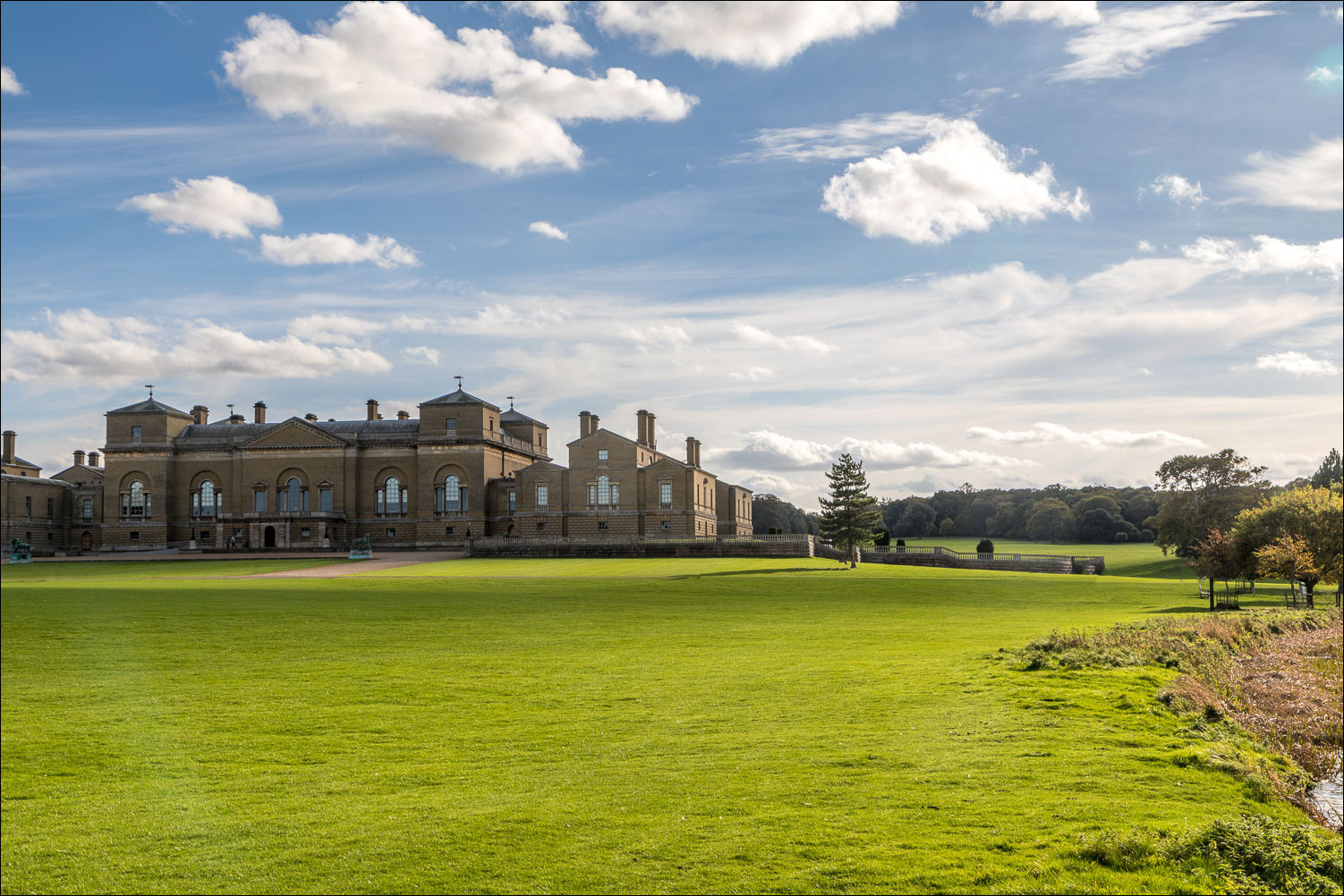
We walk round to the south front of the hall

We head across to the Walled Garden, which unusually is some distance away from the hall...


We enter the Walled Garden

According to one of the gardeners, everything in here is edible - 'including the chickens'

Cut flower border

The vegetable garden

The vineyard...


Dahlia...


We leave the Walled Garden and start the Nature Trail at the head of the lake

Red deer stag

The path leaves the lakeshore briefly in order to pass by the flint church of St Withburga

Back to the lakeshore...


A small island near the foot of the lake

You'll have to take my word for it that the dot at the top of the dead tree is an osprey - where is the long lens when you most need it?

Looking back along the lake

We arrive back at Holkham Hall and the end of a very enjoyable amble

Leaving the park, another photo of a red deer stag
