
Route: Hallin Fell
Area: Far Eastern Lake District
Date of walk: 4th November 2017
Walkers: Andrew
Distance: 3.6 miles
Ascent: 1,100 feet
Weather: Sunshine and showers
I parked opposite St Peter’s Church on Martindale Hause, which gave me a good leg up today’s objective, Hallin Fell. The climb up the grassy slopes started immediately and it was very easy going – I was at the top within 20 minutes
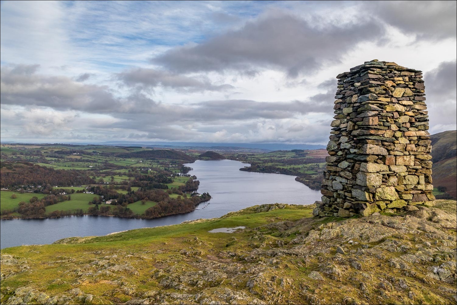
The summit of this modest little fell has two points of interest – a wonderful view over Ullswater, and a massive summit cairn out of all proportion to the height of the fell – a monument which can be seen for miles around. Having taken in the views I then descended to the shore of Ullswater down a steepish grassy path not shown on the OS map, which brought me to the wonderful shoreline path, part of the Ullswater Way, which runs to the head of the lake
After walking along the shore for 20 minutes or so I turned inland on reaching Sandwick Bay, climbing up through woodland beside a dry stone wall, and joined the elevated path along Hallin bank. This was a heavenly section of the walk and I enjoyed some glorious views along the valleys of Boredale and Howe Grain
Near the end of Hallin Bank I turned left to join a path above Hause Farm which brought me back to the start of a short but very sweet walk
For other walks here, visit my Find Walks page and enter the name in the ‘Search site’ box
Click on the icon below for the route map (subscribers to OS Maps can view detailed maps of the route, visualise it in aerial 3D, and download the GPX file. Non-subscribers will see a base map)

Scroll down – or click on any photo to enlarge it and you can then view as a slideshow

Hedgehog in the garden last night...

...and next morning, a red squirrel

Later in the morning, the start of the walk from St Peter's Church Martindale

Beda Fell and Place Fell at the beginning of the climb...

... and again from higher up

Looking back down the grassy path

Boredale

Beda Fell, which separates the two valleys of Howe Grain and Boredale

First glimpse of Ullswater

Boredale again

Inquisitive herdy

Summit of Hallin Fell - as Wainwright says 'The man who built the summit cairn on Hallin Fell did more than indicate the highest point : he erected for himself a permanent memorial'

Looking towards the head of Ullswater - and an incoming shower

Dunmallard Hill at the foot of the lake

The start of the descent down a grassy path - slippery when wet

Ullswater again

Further down the descent path

One of the Ullswater Steamers, Western Belle, heading to Howtown Pier

The start of the lakeshore path as I round Geordie's Crag...


Western Belle passes by on her way to the next stop at Glenridding

Kailpot Crag

Looking back along the shoreline

Hallinhag Wood

Looking towards the head of Ullswater

Hallinhag Wood again

Gowbarrow Fell

One of the two Poetry Stones of Hallinhag Wood, marking the point where I leave the lakeshore path to climb up through the wood...


Looking back as I round the foot of Hallin Fell

Another shower brings a rainbow with it...


Hallin Bank

Wonderful views back to Ullswater...


Boredale, which always seems to catch the light so well

Looking back to Ullswater

Boredale again

Further along Hallin Bank

Foot of Beda Fell

Another photo of Boredale

I cross the ladder stile to follow the path above Hause Farm

Howe Grain beyond Hause Farm

St Peter's Church in the trees, and the end of a wonderful short walk
