
Route: Grange Fell
Area: Central Lake District
Date of walk: 31st August 2016
Walkers: Andrew and Gilly
Distance: 4.9 miles
Ascent: 1,600 feet
Weather: Cloudy with some sun at first, then rain
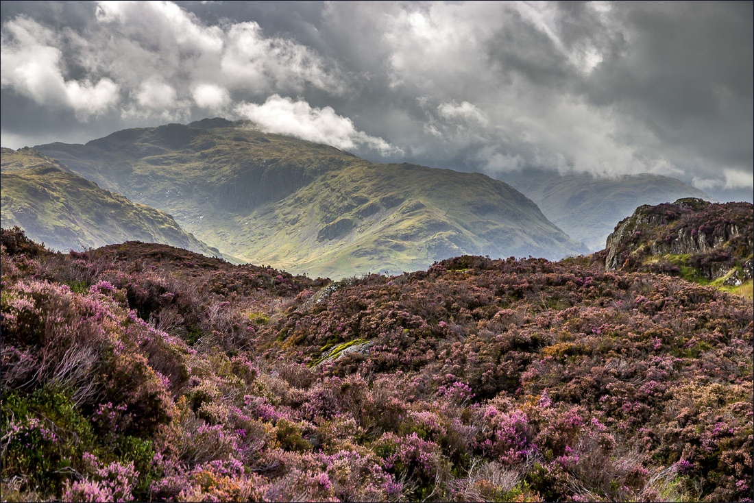
Grange Fell is a wonderful place, quite low in height but very high in beauty and a good choice for a walk when clouds are covering the higher peaks, as they were today
We parked at the National Trust Bowderstone car park and climbed up a steep but easy rocky staircase through beautiful woodland – a short but very sweet ascent to King’s How which is the best known of the three main summits of Grange Fell. The views from here were superb, taking in some of the best scenery in lakeland, and we were lucky to enjoy them in good light in view of what came later
We then made our way across the knobbly (and juicy) fell to the next summit – Brund Fell, which is the highest of the three, although the views from here are inferior to those from King’s How
We had intended to walk to the remote settlement of Watendlath and then back via Bowdergate Gill but the weather was closing in and, very content with what we’d seen so far, decided to curtail our plan. Instead we descended to Puddingstone Bank as light rain came in from the south east
This proved to be a good decision as there were several showers on the way back to the start, some of them quite heavy. This didn’t dampen our spirits though as it had been a wonderful walk and the views from King’s How will live long in our memories
For other walks here, visit my Find Walks page and enter the name in the ‘Search site’ box
Click on the icon below for the route map (subscribers to OS Maps can view detailed maps of the route, visualise it in aerial 3D, and download the GPX file. Non-subscribers will see a base map)

Scroll down – or click on any photo to enlarge it and you can then view as a slideshow

Red squirrel in the garden before we set off this morning

The start of the walk from Bowderstone car park


A full frontal assault of the fell is not possible (for walkers at least) and it’s necessary to walk round the side and sneak in via the rear entrance


Castle Crag, one of the ‘Jaws of Borrowdale’ - the other is King’s How, where we’re heading today

Grange Crags


Grange Crags again

We follow the rocky staircase

A sign of autumn approaching - fly agaric mushroom


Black Crag

Castle Crag and Borrowdale Fells from King’s How

Skiddaw and Derwent Water

Rosthwaite and its fell

Glorious Borrowdale


Our next objective - Brund Fell


Bonnie

Castle Crag

Looking back to King’s How

Rowan


Summit of Brund Fell, with several large rock towers and slabs…


Bassenthwaite Lake in the distance

We descend past Jopplety How

By now we’d decided to abandon our plan to visit Watendlath and after donning waterproofs we set off down Puddingstone Bank

We join a wider path which heads towards Borrowdale


We turn off and follow the sign for the Bowderstone

Last view of Borrowdale before we enter the woods

Frith Wood


The Bowder Stone, weighing in at around 2,000 tons

We pass by Quayfoot Quarry and the car park is just beyond - what a great walk it had been
