
Route: Fountains Abbey and Studley Royal
Area: North Yorkshire
Date of walk: 27th October 2017
Walkers: Andrew and Gilly
Distance: 7.8 miles
Ascent: 600 feet
Weather: Sunny
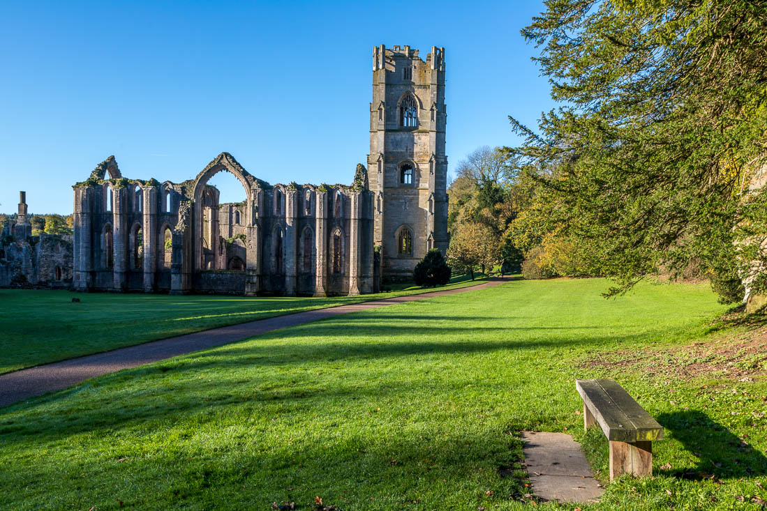
Fountains Abbey and Studley Royal is a World Heritage Site and makes for a wonderful visit, especially when combined with a walk. There are several possible routes, as the estate contains numerous paths both within the grounds and around the perimeter. We parked in the visitor centre and made our way to the atmospheric ruins of Fountains Abbey which were looking at their best on a glorious autumn morning
After wandering around for a while we walked through the adjacent Studley Royal Water Garden, laid out in the 18th century by John Aislabie to impress his guests, and containing follies, statues and eye-catching vistas. It’s a stunning garden, and the strength of the design is such that it doesn’t matter that it’s a garden with no flowers
At the end of the gardens we walked round The Lake, crossed the footbridge over the weir, and set off along the waymarked Seven Bridges Walk, which follows the River Skell, criss-crossing from bank to bank by means of 5 old arched bridges (being the remaining ones of the original 7). After crossing the final bridge we climbed uphill and followed a bridleway which brought us to Mackershaw Lodge. The purpose of this old building, which has the appearance of a gatehouse, is unknown and it’s thought that it may have been built purely as the focal point of a distant view
After passing through the lodge we arrived in Mackershaw Deer Park, where we had good sightings of a herd of red deer. The path through the park brought us down to The Lake and from here we meandered through the water gardens and the abbey back to the start of a walk which had been full of interest and beauty every step of the way
For other walks here, visit my Find Walks page and enter the name in the ‘Search site’ box
Click on the icon below for the route map (subscribers to OS Maps can view detailed maps of the route, visualise it in aerial 3D, and download the GPX file. Non-subscribers will see a base map)

Scroll down – or click on any photo to enlarge it and you can then view as a slideshow

Entrance to Fountains Abbey

Huby's Tower

The nave and Huby's Tower...


Ruins of the guesthouses

We cross the bridge over the River Skell

The Cellarium, the area where the monks ate, slept and socialised

Inside the nave

Huby's Tower again

We walk away from the Abbey towards adjacent Studley Royal, with the River Skell on our right

Looking back

We arrive at Studley Royal Water Gardens and walk round Half Moon Pond

Looking up to the Temple of Fame

One of the Moon Ponds

Statue of Neptune in the circular Moon Pond

We walk along the Lower Canal

A view back along the Lower Canal

Studley Lake at the end of the water garden. We follow a path around the water's edge

Looking back to the cascade at the head of the lake

Curtain of water

The start of the Seven Bridges Valley walk - this is one of the five surviving bridges...

It's an enchanting section of the walk as the arched bridges take us from one side of the river to another

Last of the bridges

The River Skell

We climb out of the valley

Path through the woods

Mackershaw Lodge, where we pass through the arch to enter Mackershaw Deer Park

A walk in the park

We soon spot a herd of red deer

The dominant stag (it was rutting season, so I kept well back and used a telephoto lens for these photos...)

The stag enters a pond where several of his harem are drinking and bathing...


We re-enter Studley Park

We retrace our steps around Studley Lake and take a different path back through the water garden

Looking along the upper Canal to the Rustic Bridge

Autumnal reflections in the Upper Canal

Looking along the canals to the Moon Ponds

Half Moon Pond again

Liquid gold

We arrive back at Fountains Abbey and the end of a fabulous walk

Later that day, sunset over the Humber

A few photos of the Humber Bridge...


The end of a day well spent
