
Route: Faja Racon in the Ordesa Valley
Area: Spanish Pyrenees
Date of walk: 24th June 2016
Walkers: Andrew and Gilly
Distance: 7.0 miles
Ascent: 1,900 feet
Weather: Sunny and very hot
Having visited this spectacular area earlier in the week we were keen to revisit the park, which has numerous walking routes. We’d chosen a walk known as Faja Racon and after leaving our hired car at the Pradera car park we walked back along the road towards Torla for a short distance until we reached the start of the path uphill, next to a small building in a clearing
We were confronted here by a sign which read ‘Because of a snowfall it is VERY DANGEROUS and it is advised not to follow this path’. Gulp. We had no Plan B but decided to carry on regardless, having discussed the route with Phil of Hiking Pyrenees the night before. He advised us that following this week’s heatwave most of the snow would have melted by now. We trusted this advice, and could always turn back if the route became dangerous, so started the long but easy climb through the woods until we reached the foot of the impressive cliffs
There then followed one of the most spectacular walks we’ve ever undertaken – a narrow path took us below the huge cliff face with staggering views every step of the way. I must confess that the disconcerting sign at the start of the walk had unnerved me a little and each time we rounded a corner I wondered what horrors we were going to face
We eventually came to a section of snow which was easy to overcome and not at all dangerous, though it would have been a few days ago, and a little later on there was a short slightly exposed section. Apart from that, my worries were groundless. Gilly had no such reservations and skipped along the path humming tunes from The Sound of Music
After about an hour on the faja the awesome Circo de Cotatuero and its huge waterfall came into view – a real ‘wow’ moment. We then started descending, very steeply at first, through the woodland until the path joined a wide track back to the start
It had been an unforgettable walk
Click on the icon below for a location map
![]()
Scroll down – or click on any photo to enlarge it and you can then view as a slideshow

Route map

From Pradera at the start of the walk - our path is somewhere up there

We walk back down the valley road for a short distance

When we reach this building we leave the road to walk up through the woods

Deep breaths and off we go

The initial climb to reach the Faja Racon is easy thanks to numerous hairpin bends - we’re also in woodland and out of the baking hot sun

Views of the cliffs above open up as we gain height

We pass by the Refugio de Carriata at 5,500 feet above sea level, a temporary shelter for use in emergency only

Tozal de Mallo and the Circo de Carriata

The start of the incredible high level traverse that is Faja Racon


Looking up the vertical and sometimes overhanging cliff face


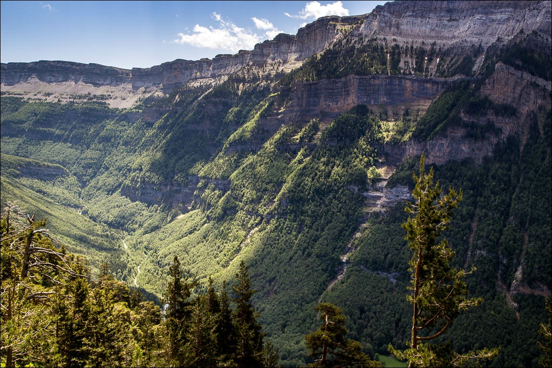
Looking across to the Sierra de las Cutas on the other side of the Ordesa Valley


Looking back along the path


Each time we round a corner there is some new wonder to behold


The Ordesa Valley and the Sierra de las Cutas

Monte Arruebo

Another awesome sight comes into view - the Circo de Cotatuero and its waterfall…


We arrive at a snowfall with a drop to the right - not a major issue though it would have been tricky before this week’s heatwave

Looking back along the Faja Racon

We continue to head towards the Cascada Cotatuero


Monte Arruebo in all its glory…


The start of the initially steep descent


We follow the sign towards Pradera

Looking back to our path, somewhere below the cliffs abvoe

We make a short diversion to admire the waterfall flowing beneath the metal bridge


The gradient eases and we enter into woodland


Gilly spots a young red deer on the other side of the river

Back to the valley floor

At the end of a never to be forgotten walk we arrive at Pradera and look back up towards the Faja Racon
