
Route: Dow Crag
Area: Southern Lake District
Date of walk: 3rd December 2014
Walkers: Andrew and Gilly
Distance: 6.8 miles
Ascent: 2,000 feet
Weather: Mostly sun and blue skies, very cold on the tops
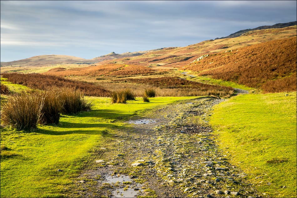
We drove up the Walna Scar Road as far as cars can go and parked in the car park beyond the gate. We then followed the road (a rough track) for about 2 miles before forking off to climb the ridge leading to Dow Crag
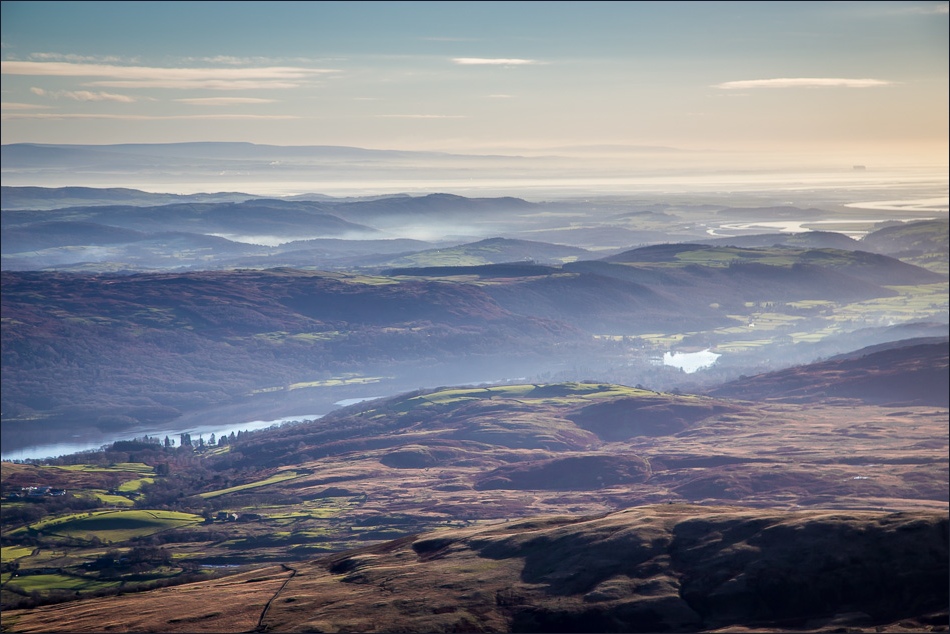
The ridge walk was superb, with extensive views over Morecambe Bay, the Duddon Estuary, the Scafells and large chunks of lakeland. There were also thrilling views down the near vertical crags on our right as the path hugged the side of the ridge. It was all quite easy going though
When we reached Dow Crag, hands were needed for the second day running in order to scramble up to the summit, which is perched on the edge of a fearsome drop
It was very cold up there so we descended quickly to Goat’s Hawse and then down to Goat’s Water. As we walked along the shore of the tarn we watched with admiration as a couple of climbers scaled the tremendous cliff face on the eastern side of Dow Crag
The path took us back to Walna Scar Road and as we made our way back to the start we reflected on what a fantastic walk it had been
Click on the icon below for the route map (subscribers to OS Maps can view detailed maps of the route, visualise it in aerial 3D, and download the GPX file. Non-subscribers will see a base map)

Scroll down – or click on any photo to enlarge it and you can then view as a slideshow
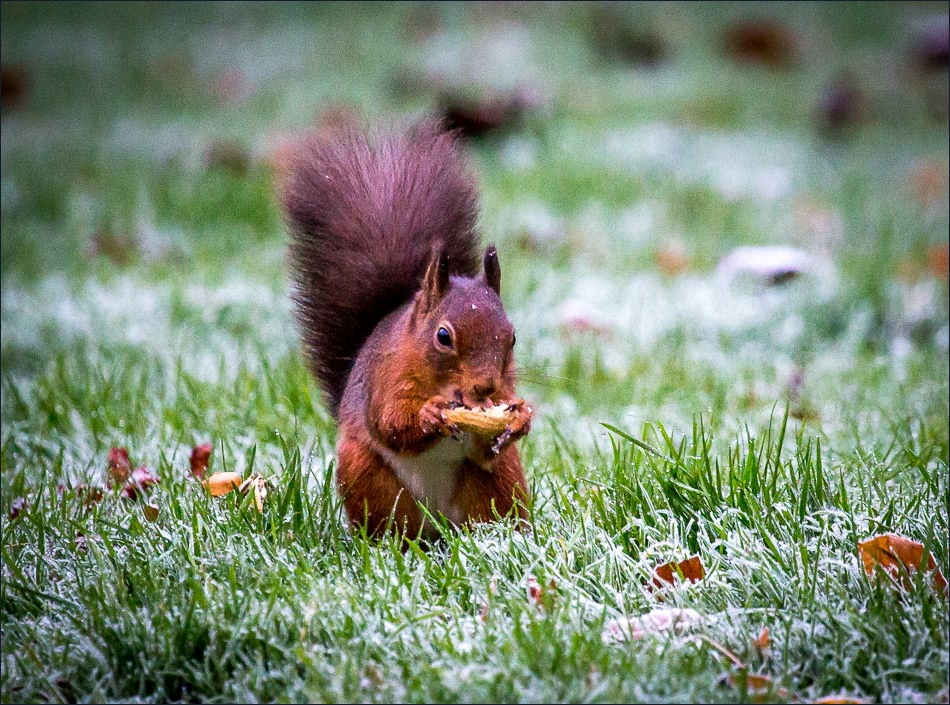
Red squirrel in the garden before we set off this morning

Start of the walk - Walna Scar Road

This easy road gradually gets us up to a height of about 2,000 feet - much easier than yesterday’s climb up Yewbarrow, though longer

The ridge to Dow Crag is ahead
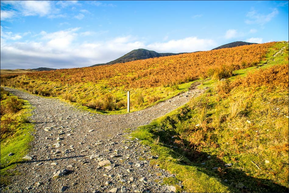
We carry on to the left and will be returning via the path to the right

The full ridge is now in view, with Dow Crag on the right of the picture
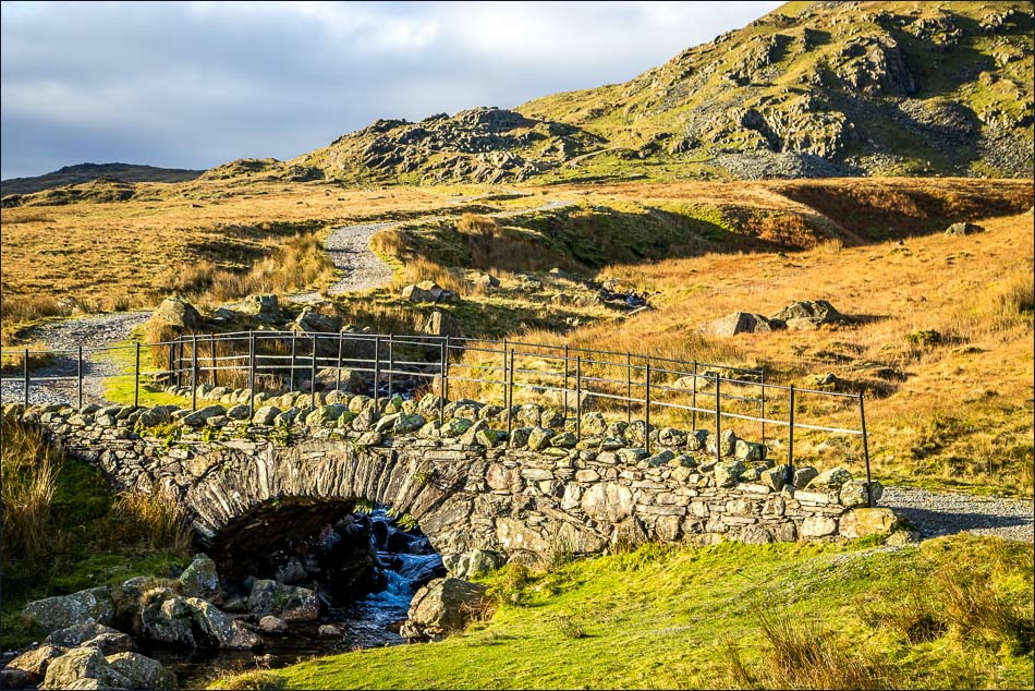
We cross Cove Bridge over Torver Beck

We disturb a heron

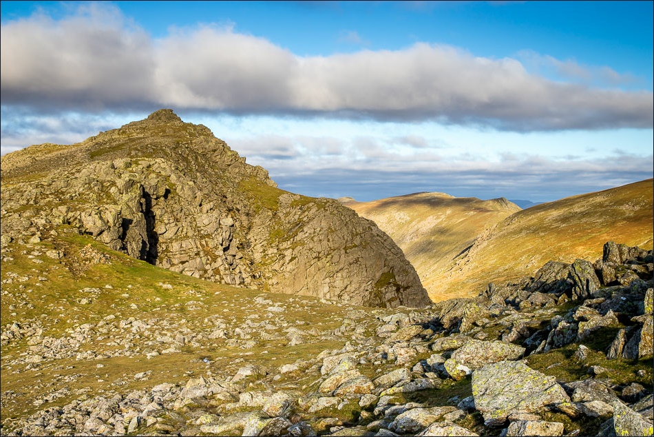
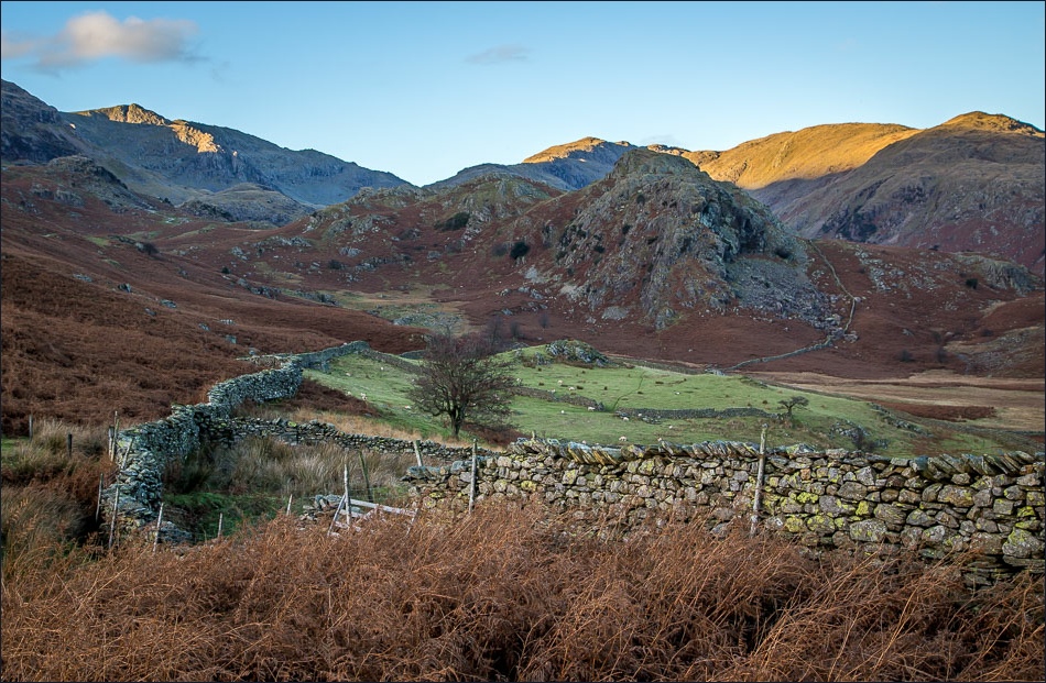
The crags of Dow Crag, with Goat’s Water out of sight in the depression

Brown Pike - we’ll soon be leaving Walna Scar Road to climb up there, the start of the ridge walk to Dow Crag

As we ascend Brown Pike, big views open up - Coniston Water and the Howgill Fells……

……and the Duddon Estuary

The shelter drawn by Wainwright and described as ‘big enough for one person or a honeymoon couple’ - or Bonnie

Gilly and Bonnie on the ridge to Brown Pike

Layers of hills beyond Coniston Water

Dunnerdale and Harter Fell from Brown Pike

The rectangular object top right is Heysham Nuclear Power Station on the far side of Morecambe Bay - 25 miles away as the crow flies

Looking back over the Duddon Estuary

Coniston Water and the Howgills beyond

Continuing along the ridge towards Buck Pike
Dow Crag summit ahead

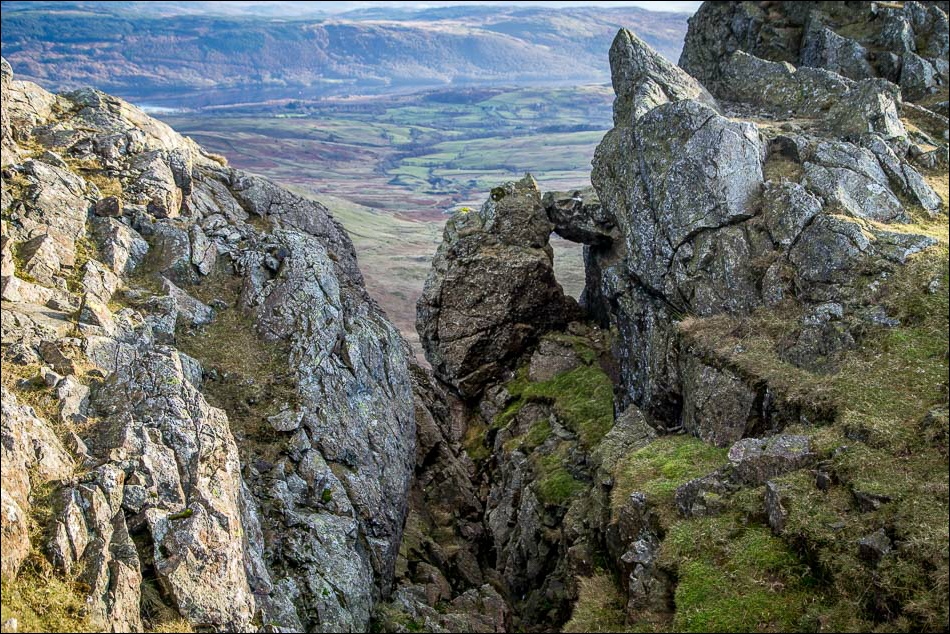
Gilly stares down one of the steep gullies

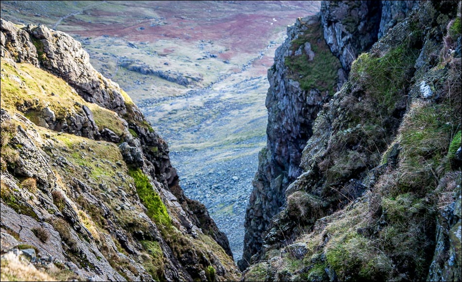
Goat’s Water - and our return path far down below

Looking across the gulf to Coniston Old Man

Gilly and Bonnie perched on the airy summit of Dow Crag

We follow the easy ridge down to the right

The Scafell Range

Goat’s Water - our return route lies along its left bank

We arrive at Goat’s Hawse before turning right to descend to the tarn

Gilly looks across Morecambe Bay as the sun starts to go down

Goat’s Water

Looking back across Goat’s Water to Dow Crag - hard to imagine we’d been up there an hour ago
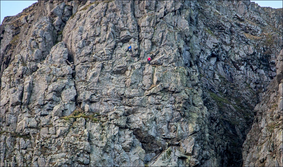
We pause to admire these intrepid climbers
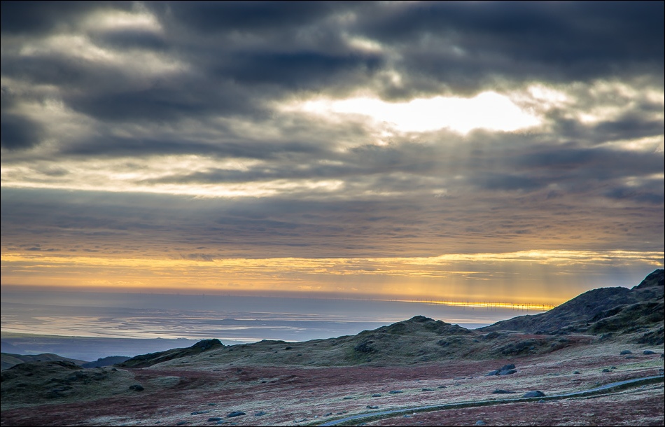
Looking out to sea as the sun starts to go down

We join the Walna Scar Road again and retrace our steps back to the start
Back to the start - a car park with a view
