
Route: Derwent Water to Buttermere
Area: North Western Lake District
Date of walk: 12th July 2017
Walkers: Andrew
Distance: 8.9 miles
Ascent: 3,400 feet
Weather: Mostly sunny
Looking at the OS map for a new route, it occurred to me that a journey from Derwent Water to Buttermere would be a very satisfying walk, linking two of Lakeland’s most beautiful lakes via a high level traverse. I’ve not heard of this walk being done before, although no doubt it has. The route which I plotted involves climbing six Wainwright fells: (in order of appearance) Causey Pike, Sail Fell, Scar Crags, Eel Crag, Wandope and Whiteless Pike. I’ve been up these fells several times before but never in this combination
As this is a linear walk, thought has to be given as to transportation and in my case Gilly’s taxis offered a solution. We drove together to Hawse End and walked down to the shore of Derwent Water. After dipping my boots in the lake I said goodbye to Gilly and set out on the walk to Buttermere. The first section of the walk crossed Newlands valley and was a joy every step of the way, although there was a potential snag when I arrived at Newlands Beck. The bridge over the beck had been washed away in the 2015 floods and, unbeknown to me, not yet replaced. Fortunately there were some rocks nearby which provided a crossing, though it was a precarious one and I’d recommend anyone following this route to proceed to the foot of Causey Pike via Stair, rather than risking a dunking in the beck
Having crossed the beck, the collar work soon began as I commenced the climb up Rowling End, followed by the mild scramble to the top of Causey Pike – hands are needed on the final section but there are no difficulties. There then followed several downs and ups as I ticked off the next five fells along the route. At last I arrived at the last one, Whiteless Pike, and from there descended into Buttermere village where I was re-united with Gilly. We walked together to the shore of Buttermere and I dipped my toes in the water at the edge to complete a wonderful walk from lake to lake
Click on the icon below for the route map (subscribers to OS Maps can view detailed maps of the route, visualise it in aerial 3D, and download the GPX file. Non-subscribers will see a base map)

Scroll down – or click on any photo to enlarge it and you can then view as a slideshow

Red squirrel before we set off to Derwent Water

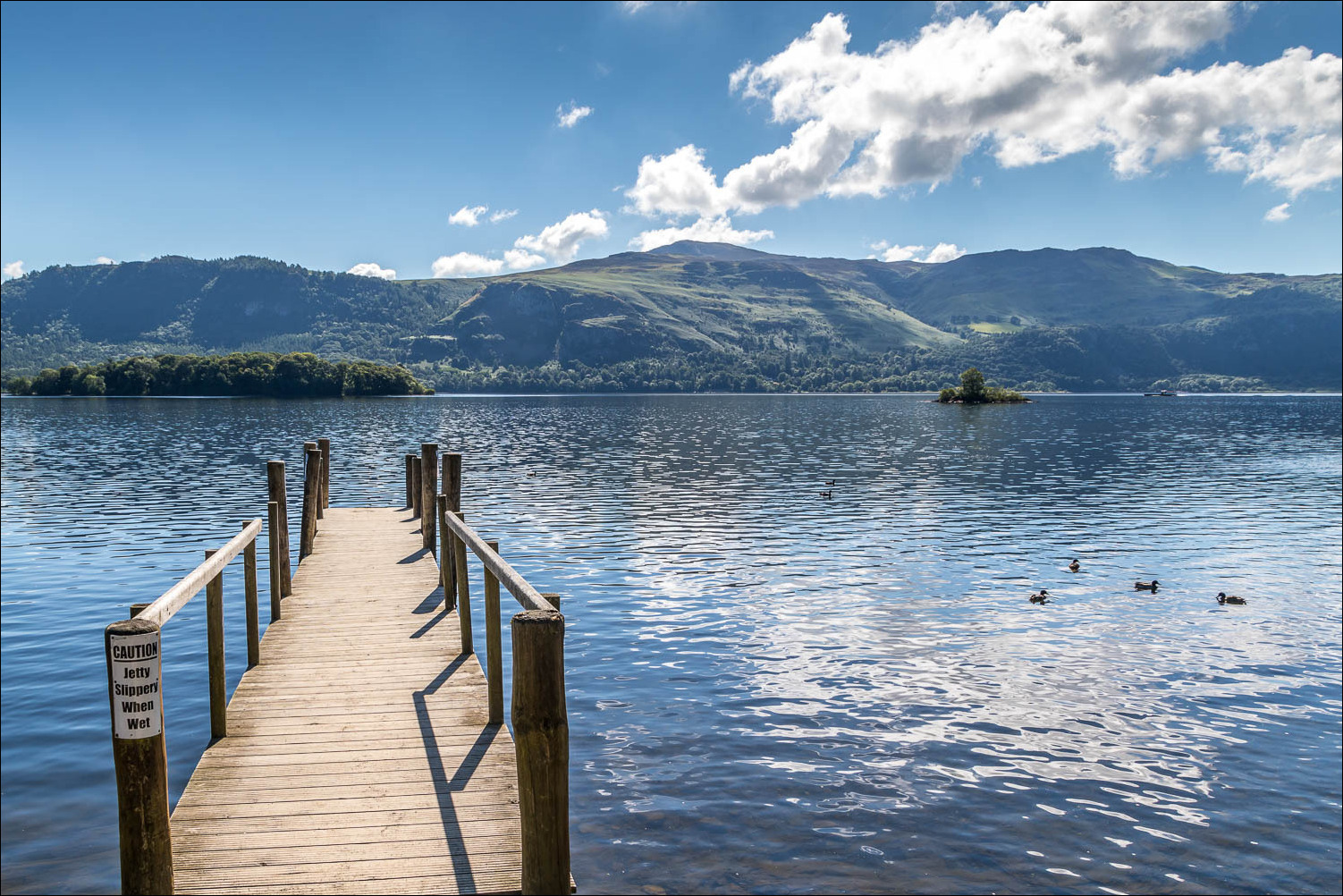
Hawse End jetty at the start of the walk from lake to lake

As I approach Skelgill my first objectives, Rowling End and Causey Pike, come into view

Walking across Newlands Valley...


Rowling End

Hindscarth at the head of the valley

I follow the path towards Rowling End Farm

Ahead is Newlands Beck and the missing bridge - I managed to cross the beck though not without difficulty

Safely across, I start the climb up Rowling End, here looking towards Skiddaw

Catbells across the valley

Newlands Valley

Looking back to Derwent Water...

...and to Skiddaw

The distinctive knobbly top of Causey Pike

Maiden Moor, Hindscarth and Robinson

Looking back along Rowling End to Derwent Water

The final section to the summit involves some handwork, but it's an enjoyable clamber

A view along the ridge from the summit of Causey Pike

Ard Crags

Zooming in on Derwent Water

Blencathra

Newlands Valley

I follow the line of the ridge towards Sail and Eel Crags

Aikin Knott on my left

...and Force Crag Mine on my right

Cairn on Scar Crags

Looking towards the controversial path up to Sail

On a positive note, the fellside is completely featureless and the zigzags facilitate what would otherwise be a steep trudge

Numerous fells, including Great Gable on the right

First glimpse of Buttermere along the valley

The insignificant summit cairn on Sail, here looking towards the Solway Firth and Scotland

Zooming in on the Solway Firth beyond Whiteside

I continue along the ridge towards my next objective, Eel Crag

Grisedale Pike

Summit of Eel Crag, with the Solway Firth in the distance

Grasmoor from Eel Crag

I follow a wonderful path along the edge of Addacombe Hole towards the penultimate summit, Wandope

Summit of Wandope

Looking down to Crummock Water

A down and an up to the final summit on the route - Whiteless Pike

Buttermere from Whiteless Pike

My destination - the foot of Buttermere

Looking across to Crummock Water, Loweswater and Scotland beyond

Haystacks ahead as I descend to Buttermere

I follow the grassy slopes towards the village

Rannerdale Knotts

Sourmilk Gill flowing into Buttermere

Foot of High Stile

Haystacks, with Great Gable behind it

Sourmilk Gill again

I arrive in Buttermere village and follow the path past the cottages

Path to the lake, and Fleetwith Pike in the background


Journey's end - Buttermere. What a wonderful walk
