
Route: Cruz del Carmen to Chinamada
Area: Anaga Peninsular, Northern Tenerife
Date of walk: 9th February 2018
Walkers: Andrew and Gilly
Distance: 9.0 miles
Ascent: 2,200 feet
Weather: Mostly cloudy, sunny near the coast, a few showers
Two days ago we’d enjoyed a classic walk in the remote Anaga area located in the north east of the island. More bruma (the Spanish for thick clag) was shrouding the hills near our base, so we decided to return to Anaga in the hope of better conditions
The weather wasn’t particularly good as we parked our hired car in the free car park at Cruz del Carmen (where there is a visitor centre, toilets and a restaurant). With low clouds and mist rolling around we set out along a trail which started at the right hand side of the restaurant and entered into a dense laurisilva forest. The air was misty and damp as we followed the path up and down through woodland, eventually emerging into the light with a promise of some better weather nearer the coast, in our direction of travel
Our destination – the small settlement of Chinamada – came into view in the distance. The residents still live in caves as did their ancestors and up until the 1990’s there was neither electricity nor a road. We arrived in the village, where many of the caves now boast brick built extensions, with the cave itself being out of sight at the back of the house
We made a there and back diversion to the signposted Mirador Aguaide and after admiring the spectacular view returned to the village and set off for the next village, Las Carboneras. The first section was along the road, but after a while we were able to join a mildly vertiginous path which took us high above the road, affording more spectacular views along the way
Beyond Las Carboneras we joined an uphill path which took us back into the forest and after what seemed like a long slog we rejoined our original path and retraced our steps back to the start. It had been another grand adventure in this wonderful walking area
Click on the icon below for the route map
![]()
Scroll down – or click on any photo to enlarge it and you can then view as a slideshow

The day before the walk, a visit to Garachico for some wave watching...


Next day, the start of the walk from Cruz del Carmen, where we enter a laurel forest immediately after leaving the car park

After a few minutes we arrive at a dirt track to be greeted by the view across the terraced barranco of Batán

We pass by a remote smallholding


The extraordinary rocket shaped Roque de Taborno looms out of the mist as we follow a short and quiet road section

We leave the road here to descend down a narrow path

Roque de Taborno again

Zooming in - the mountain mist gradually disappears as we approach the coast

We turn left by this bench to follow an exciting path which contours around the mountain side...


Thrilling views across the barranco, where terraced fields have been carved into the hills


We pass by a goat farm...

...and a potato field with a view

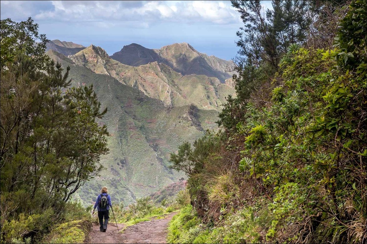
We continue along the path...


Looking back to the farm we'd passed earlier


Our destination, Chinamada, comes into view

As we continue towards the village there are spectacular views of Roque los Pinos and the mountains beyond it...


We arrive at Chinamada, where the inhabitants still live in caves. This one, like others, boasts an extension at the front


Looking back to the village as we make a there and back detour to the viewpoint of Mirador Aguaide...


The mirador...

...and the views from it


Punta del Hidalgo in the distance

We return to the village, passing by small terraced fields

After leaving Chinamada we walk along the road to Las Carboneras

Looking back to Chinamada


After 15 minutes or so we're able to leave the road and ascend high above it to follow the path to Las Carboneras

The road can just be seen below as we follow the narrow path around the mountain side

Roque de Taborno again, and the road down below


Las Carboneras ahead...


We walk through the village

Just beyond the village we leave the road to join the path back to Cruz del Carmen

Eucalyptus tree

We reach a junction which we'd crossed earlier in the walk, and from here we retrace our steps back to the start

Looking back to Chinamada

We return to the start through the misty laurisilva forest

Final photo of the walk, and what a wonderful walk it had been

Later that afternoon, a glimpse of mighty Mount Teide from our hotel room - its head had been under the clouds for most of the week
