
Route: Castle Crag
Area: North Western Lake District
Date of walk: 16th March 2016
Walkers: Andrew and Gilly
Distance: 5.1 miles
Ascent: 1,000 feet
Weather: mostly cloudy
At a height of 985 feet, Castle Crag is the lowest of the lakeland fells as classified by Alfred Wainwright, and the only one under 1,000 feet to be honoured with the full treatment in the Pictorial Guides to the Lakeland Fells – ‘a distinction well earned’ according to AW, who went on to say ‘If a visitor to lakeland has only two or three hours to spare, poor fellow, yet desperately wants to reach a summit and take back enduring memories of the beauty and atmosphere of the district….let him climb Castle Crag.’
With limited time to spare this afternoon, and recalling those words of wisdom, we parked in the National Trust car park in Rosthwaite and walked towards the bank of the River Derwent, following the course of the river for a short distance before crossing over New Bridge to start the climb up to Castle Crag. Eventually we reached the quarry area, and from here it’s a short but steep pull up a zigzag staircase of loose slate
The views from the top were as wonderful as ever and after savouring them for a while we retraced our steps down the slate staircase and then joined the Cumbria Way heading south towards Seatoller.
After passing through Seatoller we followed the River Derwent through Johnny Wood and from there back to Rosthwaite. It had been a wonderful walk in one of lakeland’s most beautiful valleys
For other walks here, visit my Find Walks page and enter the name in the ‘Search site’ box
Click on the icon below for the route map (subscribers to OS Maps can view detailed maps of the route, visualise it in aerial 3D, and download the GPX file. Non-subscribers will see a base map)

Scroll down – or click on any photo to enlarge it and you can then view as a slideshow

A dawn visit to Buttermere before the start of the walk…


On the way back I noticed some mist over Loweswater…


The track from Maggie’s Bridge to Loweswater


Heading back to the car

Back home, the local wildlife was out in force - a jay…

Tortoiseshell

Buzzard, one of 4 which were working the valley

Red squirrel

Spring lambs in an adjoining field

After all those distractions we didn’t set off until the afternoon, by which time it had clouded over. This is the start of the walk from Rosthwaite

The track leading out of Rosthwaite to the River Derwent

Castle Crag

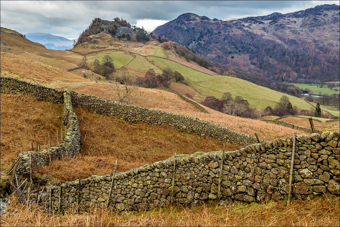
Looking back along Borrowdale to Eagle Crag

We could have crossed the Derwent via the stepping stones, but I enjoy the cobbled path on this side, and the lovely old bridge at the end of it…


New Bridge, which was new once upon a time

We walk along the other side of the Derwent for a short distance in the direction of Grange Fell

We leave the path here to start the climb up Castle Crag

Looking back to Rosthwaite


We follow a zigzag path up a spoil heap of discarded slate - there are numerous old quarries and caves around the fell

The summit quarry

Skiddaw and Derwent Water from the summit of Castle Crag

Bonnie

Looking down to the Cumbria Way, which we’ll be following shortly

We descend the same way we’d ascended

Derwent Water again

We follow the Cumbria Way


Looking back to Castle Crag

We pass above Rosthwaite

Descending to Seatoller


Seatoller, at the foot of the Honister Pass


Johnny Wood

The River Derwent

A good use for old walking boots, as we walk through the grounds of the youth hostel


We cross over the River Derwent at Longthwaite

Castle Crag again as we walk through the fields into Rosthwaite

Back to the start of a superb walk
