
Route: Boredale and Howe Grain
Area: Far Eastern Lake District
Date of walk: 5th May 2016
Walkers: Andrew
Distance: 6.3 miles
Ascent: 1,500 feet
Weather: Sunny
Today’s walk linked a visit to two of my favourite valleys in the district both of which are remote and unfrequented. Boredale and Howe Grain can only be reached by car after driving along the narrow lanes on the east side of Ullswater and then up the steep zigzags to Martindale Hause
I parked by the old church and after crossing nearby Christy Bridge I followed the lane along Howe Grain as far as Dale Head. The remote location of the lane, and the fact that it’s a dead end, means that there is little or no traffic
The area is home to the oldest red deer herd in England, and as I reached Dale Head it was a thrill to see a small group of them. From Dale Head there followed an easy climb along the slopes of Beda Fell up to Boredale Hause, with more red deer sightings, and as I descended into Boredale I spotted two more herds – at a guess I saw about 100 individuals during the walk
At Boredale Head I joined the valley road – another quiet lane with little or no traffic – and followed this almost as far as the foot of the valley before turning off to climb a path over Howstead Brow, and from there back to the start
For other walks here, visit my Find Walks page and enter the name in the ‘Search site’ box
Click on the icon below for the route map (subscribers to OS Maps can view detailed maps of the route, visualise it in aerial 3D, and download the GPX file. Non-subscribers will see a base map)

Scroll down – or click on any photo to enlarge it and you can then view as a slideshow

Red squirrel in the garden on the morning of the walk

The Old Church Martindale at the start of the walk


Christy Bridge

Howegrain Beck

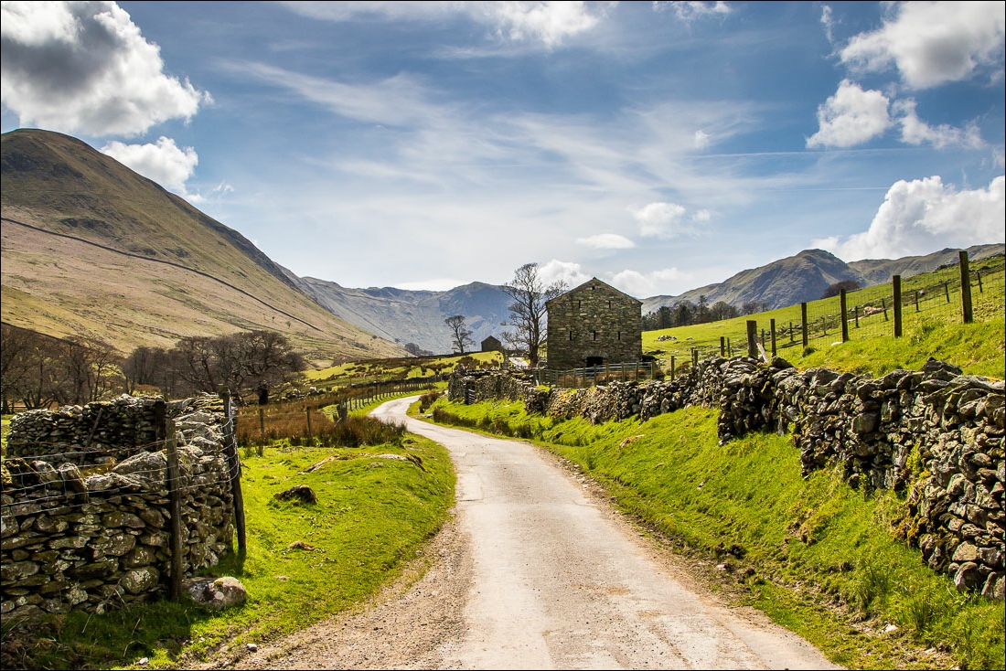
I follow the lane and pass behind these two old barns

Looking across Howegrain Beck to the other side of the valley


Henhow


Approaching the head of Howe Grain valley

Red deer on the flanks of Beda Fell

I pass through Dale Head before the start of the climb up to Boredale Hause

The head of Bannerdale

I fork off to the right here to start the climb up to the hause

More red deer

The head of Bannerdale again…


The end of the climb as I start to descend to Boredale Hause

Helvellyn in the distance and my descent path bottom right

Start of the descent into Boredale

Another herd of red deer below

Looking back along the path from Boredale Hause

Boredale Head, and from here I follow the lane along the valley


Boredale Beck

Heron in a small unnamed tarn near the foot of Boredale


I leave the lane just beyond these buildings

A short up and down follows over Howstead Brow

A view back to Ullswater

Over the brow now, and I arrive back in Howe Grain valley

Howegrain Beck again, and from here it’s a short stroll back to the start
