
Route: Bamburgh Castle
Area: Northumberland
Date of walk: 29th March 2015
Walkers: Andrew and Gilly
Distance: 6.2 miles
Weather: Rain then sun, then rain again
We parked in the village of Bamburgh but it was raining and so instead of starting the walk as we’d intended, we decided to visit the museum in Bamburgh Castle – a good decision as it was a fascinating place. The castle has stood guard above the spectacular Northumberland coastline for over 1,400 years. Spanning nine acres of land on its rocky plateau, it is one of the largest inhabited castles in the country.
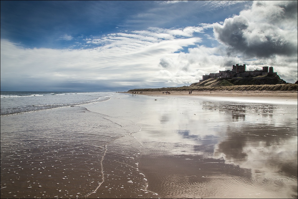
The weather took a turn for the better so we left the castle and set off through the sand dunes down to the beach. We walked along the sands admiring the wonderful views back to the castle as we went along
Just before Budle Point, the tide dictated that we should head uphill to the path shown on the OS map. As we rounded the Point, there were fabulous views across the bay
We then headed inland but after a while it started raining again, so we decided to cut short our planned circuit and return to Bamburgh along the road. This was another good decision, as it left us with enough time for a wonderful walk on Holy Island…
For other walks here, visit my Find Walks page and enter the name in the ‘Search site’ box
Click on the icon below for the route map (subscribers to OS Maps can view detailed maps of the route, visualise it in aerial 3D, and download the GPX file. Non-subscribers will see a base map)

Scroll down – or click on any photo to enlarge it and you can then view as a slideshow

It was raining as we arrived in Bamburgh

Bamburgh Castle

We decided to enter the castle in order to keep dry, and in the hope that the weather would improve

After a fascinating and instructive tour of the museum, we came back outside to improving conditions

Rainbow over Holy Island in the far distance


Looking back up to the castle as we descend through the sand dunes


We walk along the beach towards Bamburgh Lighthouse

Looking back

We walk along the beach, passing by Bamburgh Castle again

Looking back to the castle

Bamburgh Lighthouse

The retrospective views of the castle were wonderful


Approaching the lighthouse


Harkness Rocks, known locally as Stag Rocks for obvious reasons - it’s a mystery as to why this is here and who painted it

Another look back to Bamburgh Castle

Budle Bay round the corner

Walking round Budle Point

Budle Bay, and Holy Island (where we’d be walking later that day) in the distance

Stonechat

A shortcut back to the start but we decided we’d rather avoid the main road…

……and preferred to follow this quiet lane back to the start
